Product details
Home to vast stretches of untouched wilderness, the Cariboo Chilcotin Coast is one of Canadaâs final frontiers. With towering mountains scraping against the sky, sprawling steppes covered with wildflowers, remote valleys carved by ancient rivers and an untamed ocean coast teeming with wildlife, this region is a backcountry explorerâs dream. Reel in the catch of a lifetime on one of the Fishing Highwayâs incredible lakes, explore the bays and inlets around Bella Coola on a sea kayaking adventure or get away from it all amid the natural splendour of Tweedsmuir Provincial Park!
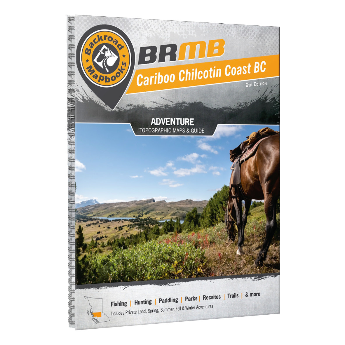
The 6th edition Cariboo Chilcotin Coast Backroad Mapbook features numerous additions and expansions from Backroad Mapbooks' last edition, including more fish species, enhanced private land, updated logging roads, countless new Adventure recreational Points of Interest, updated trails, extensive snowmobiling and ATVing additions and new Community Profiles, this is your ultimate guide to exploring the Cariboo Chilcotin Coast!
The printed version of the mapbook comes in the convenient 21.5 x 28 cm (8.5 x 11 inch) mapbook format with a heavy-duty spiral-bound cover. The 224 page book includes 59 maps at 1:250,000 scale, along with 12 Outdoor Adventure sections, a Community Profile section, Service Provider Directory, Map and Adventure Index, Trip Planning tools and more. With over 135,000 kilometres of roads to view including the most complete logging and industrial road coverage available, the books are ideal for navigating on road trips and planning from home.
Print Features
- Map Key & Legend
- Topographic Maps
- 59 @ 1:250,000 Scale Maps
- 1 @ 1:80,000 Scale Map
- Detailed Adventure Section
- Backroad Attractions
- Fishing Locations
- Hunting Areas
- Paddling Routes
- Parks & Campsites
- Trail Systems
- ATV Routes
- Snowmobile Areas
- Wildlife Viewing
- Winter Recreation
- Backcountry Hut & Cabin
- Service Directory
- Accommodations
- Sales & Services
- Tours & Guides
- Index
- Adventure Index
- Map Index
- Trip Planning Tools
Features
Topographic Maps
In your durable, heavy-duty, spiral-bound 21.5 x 28 cm (8.5 x 11 in) Cariboo Chilcotin Coast Mapbook you will find 59 detailed topographic maps spanning the region, complete with labelled recreation sites, amenities, highways, backcountry roads, trails and other Points of Interest. These user-friendly maps boast a level of cartographic sophistication unparalleled even by government sources, making them the maps of choice for loggers and Search and Rescue teams.
Service Directory
In addition to their maps, they list the Cariboo Chilcotin Coast's best accommodations, services, outfitters and amenities, including information on the region's best outdoor tours and hunting and fishing suppliers.
Adventures
The detailed adventure section is one of the features that makes your Backroad Mapbook so much more than just a map of the Cariboo Chilcotin Coast. From hiking to hunting, ATVing, paddling, wildlife viewing and beyond, our team of writers and researchers have come up with the most comprehensive adventure information available anywhere for this region.
Index
The easy-to-use index is divided into Map and Adventure sections to make it even simpler to navigate. Here you will find page numbers and map coordinates for each activity and location, plus important numbers, distance charts and an advertiser list for easy referencing.
Community Profiles
New to this edition, they have included detailed profiles for the major communities of the Cariboo Chilcotin Coast, including Lillooet, Williams Lake, Quesnel, Wells, Barkerville, Likely, Bella Coola and several others. Here you will find information on the most exciting things to do in and around town.
Specifications
- Released: 2021
- UPC: 6-22098-00147-1
- ISBN #: 978-1-926806-86-0
- Pages: 224
- Dimensions: 21.5cm x 28cm (8.5" x 11")
- Maps: 59 maps @ 1:250,000 + 1 map @ 1:80,000 scale
- Digital Format Available: Yes.
- Map Features: Highways, Logging Roads, Land & Water Features, Parks, Adventure Points of Interest, Campgrounds, Hiking Trails, Motorized Trails, Paddling Routes, Hunting & Fishing Areas, Winter Recreation and more
- Areas Covered: 100 Mile House, Alexis Creek, Anahim Lake, Barkerville, Bella Bella, Bella Coola, Bridge Lake, Clinton, Gold Bridge, Horsefly, Likely, Lillooet, McBride, Quesnel, Wells, Williams Lake, & more
Add your review
Review Cariboo Chilcotin Coast BC Backroad Mapbook