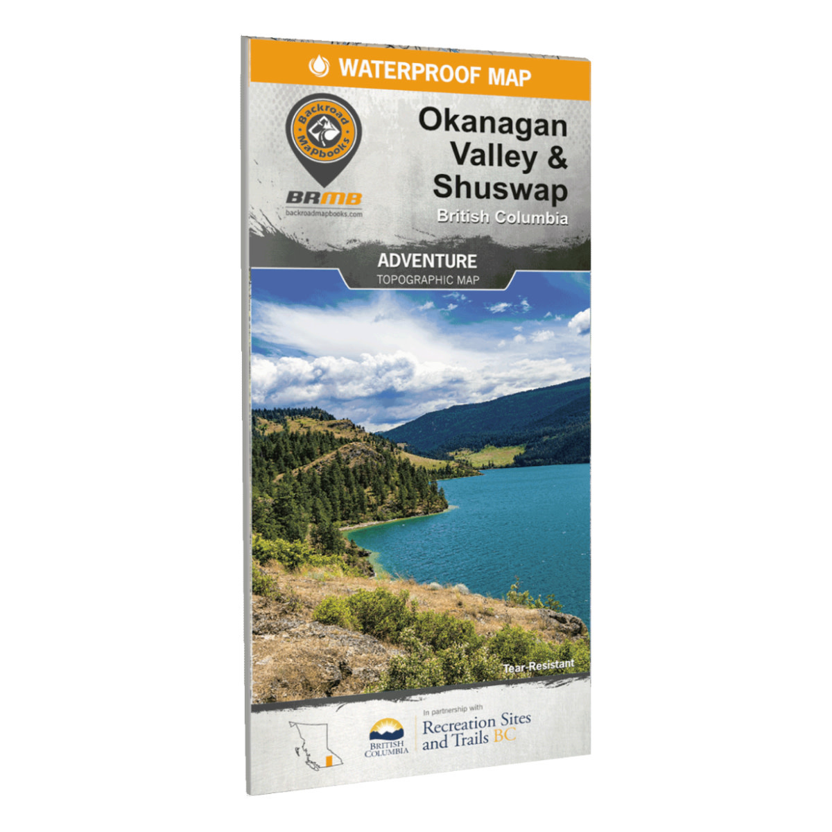
Product details
Located in the heart of BC's southern interior, the Okanagan Valley is a diverse and beautiful area with year-round outdoor adventure opportunities. From arid desert plains to crystal-clear mountain streams and old-growth forests, the Okanagan is famous for both its sunshine and snow. This map charts the entire Okanagan Valley and Shuswap area, from Adams Lake and the upper reaches of the Shuswap Lakes to the north, Revelstoke and Granby Provincial Park to the east, and Grand Forks and the historic Greenwood to the south, along with coverage of outdoor recreation hotspots such as Osoyoos, Kelowna, Vernon, and Salmon Arm. Whether you are looking to hike, bike, camp, fish, paddle, swim, ski, snowshoe, hunt or ATV, this map gives you the most comprehensive coverage available anywhere for one of Canada's most sought-after outdoor destinations.
Print Features
- Printed on durable waterproof and tear-resistant material
- Easy to read, large-scale 86 x 117 cm (34 x 46.25 inch) map derived from their Backroad Mapbooks at 1:20,000 scale
- Includes industry leading cartographic detail and state-of-the-art relief shading
- The most complete recreation, industry and country road coverage available for the Okanagan
- Valley & Shuswap Lake areas
- Countless points of interest, hiking trails, campsites, beaches, paddling routes and more
- Numerous updates and expansions from our last edition
- Addition of private land areas to help you avoid off-limits areas
- Detailed index for recreation sites, trails, and provincial parks
- Seamless map coverage requires no page turning
Features
This tear-resistant, waterproof map of the Okanagan Valley & Shuswap is easy to use and carry on all your outdoor adventures. This newest edition of the map includes industry-leading topographic detail, unparalleled road coverage and countless trails, rec sites, and paddling routes, along with labelled fish species and stocked fishing lakes and rivers. Numerous updates and expansions from our last edition make this the most up-to-date topographic map available for the Okanagan Valley & Shuswap!
- Industry-leading cartographic detail and topographic relief shading
- Enhanced private and leased land areas to help you stay out of private lands
- Thousands of kilometres of trail systems for ATVing, paddling, snowmobiling, hiking, mountain biking, cross-country skiing and snowshoeing
- Highlighted Wildlife Management Units (WMUs) for anglers and hunters
- Labeled fish species and stocking information for fishing lakes and rivers
- Hundreds of geographic features, land and water
- National, Provincial and Regional Parks and Campsites
- Labelled downhill and Nordic ski areas
- Detailed index for easy reading
- And much more!
Specifications
- Released: 2021
- UPC: 6-22098-11003-6
- ISBN #: 978-1-989175-04-0
- Pages: 2
- Paper: Waterproof, Tear-resistance.
- Dimensions: 86 x 117 cm (34 x 46.25 inches)
- Maps: 2 sides @ 1:150,000
- Digital Format Available: Yes.
- Map Features: Highways, Logging Roads, Land & Water Features, Parks, Adventure Points of Interest, Campgrounds, Hiking Trails, Motorized Trails, Paddling Routes, Hunting & Fishing Areas, Winter Recreation and More.
- Areas Covered: Adams Lake, Armstrong, Beaverdell, Chase, Cherryville, Christian Valley, Enderby, Falkland, Grand Forks, Greenwood, Kelowna, Keremeos, Lake Country, Naramata, Oliver, Osoyoos, Peachland, Penticton, Salmon Arm, Seymour Arm, Sicamous, Vernon & more
Add your review
Review Okanagan Valley BC Waterproof Adventure Map