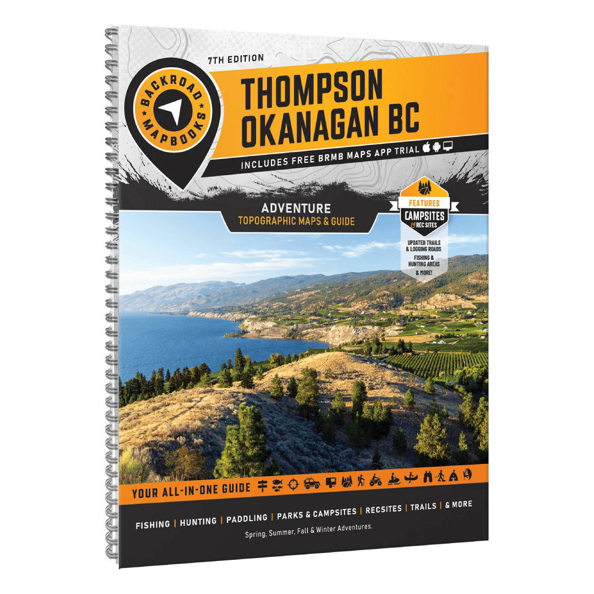
Product details
From the watersport haven of Okanagan Lake and the desert beauty of Osoyoos, to the beaches of the Shuswap, lush forests of Manning Provincial Park, and the rugged wilderness of Wells Gray and Mount Robson, this region is a dream for outdoor enthusiasts.
Whether you’re into camping, hiking, fishing, ATVing, snowmobiling, hunting, cross-country skiing, or paddling, Backroad Mapbooks offers the most detailed and easy-to-use guide for navigating BC’s wild heart.
Durable Spiral-Bound Format
- ISBN: 978-1-989175-42-2
- Release: 2026
- Pages: 288
- Dimensions: 21.5cm x 28cm (8.5" x 11")
Map Scale & Area
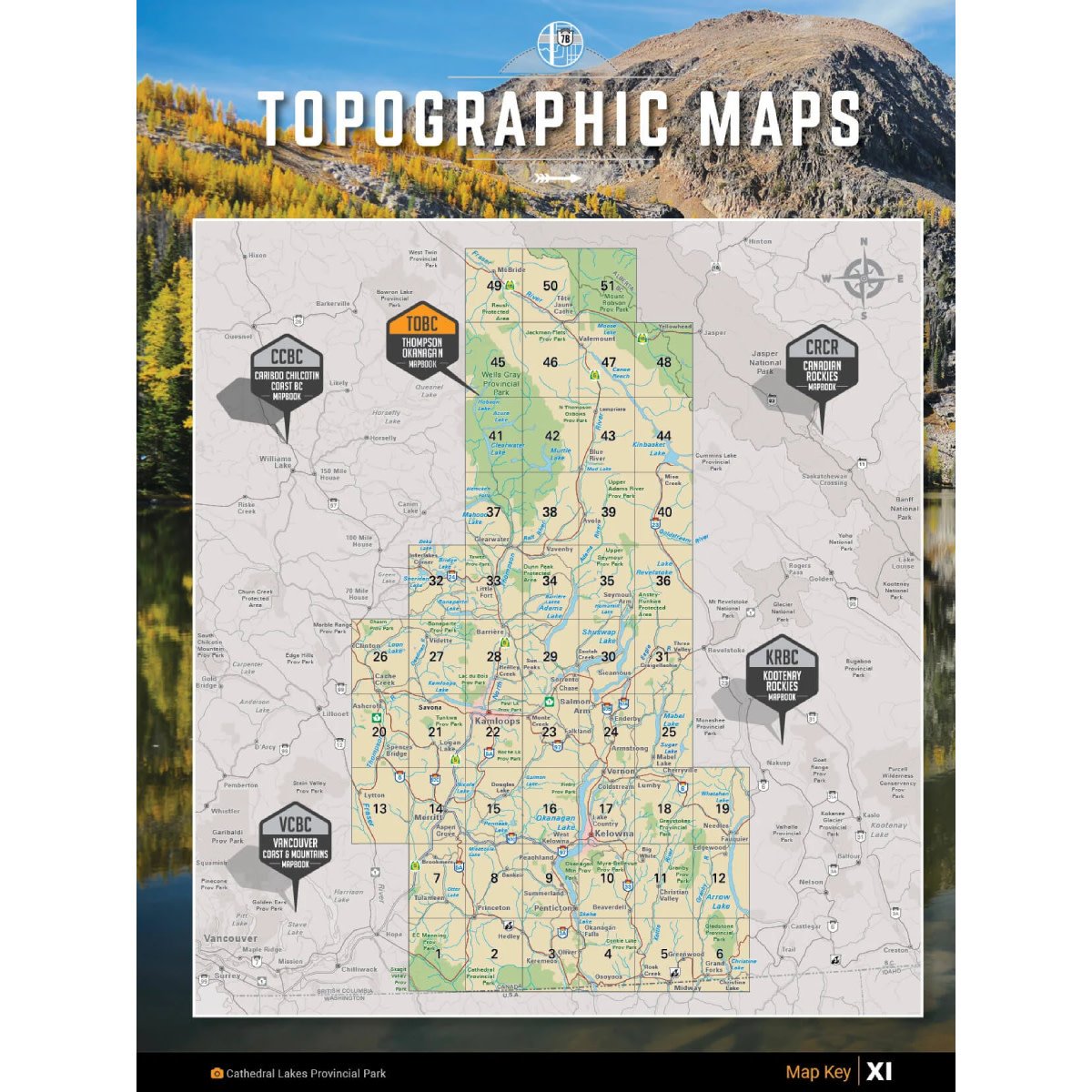
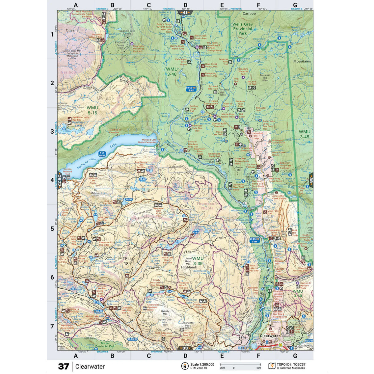
Map Scale: 51 maps @ 1:200,000
This mapbook includes Cache Creek, Clearwater, Grand Forks, Kamloops, Kelowna, McBride, Merritt, Penticton, Princeton, Salmon Arm, Savona, Valemount, Vernon, & more
Features Included
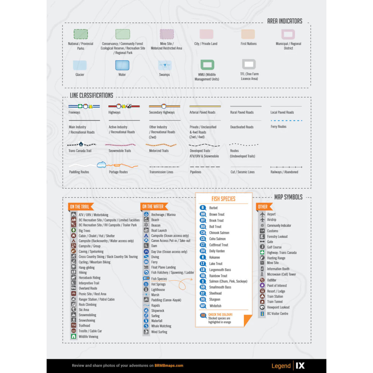
Highways, Logging Roads, Land & Water Features, Parks, Adventure Points of Interest, Campgrounds, Hiking Trails, Motorized Trails, Paddling Routes, Hunting & Fishing Areas, Winter Recreation and More.
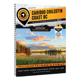
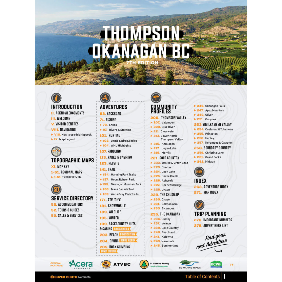
What's new in the 7th Edition
Explore Thompson Okanagan like never before with our most detailed and updated Mapbook yet. Whether you're trekking deep into the backcountry or cruising your favourite ATV route, this edition brings you enhanced coverage, fresh adventure listings, and exclusive new features:
- Expanded road networks & multi-use trail systems
- Updated hunting details with WMU descriptions & LEH info
- Additional stocked fishing lakes + new charts
- New Overland & ATV routes for epic rides
- Fresh rock climbing, beach & diving destinations
- Detailed Community Profiles across the region
- Bonus: Brand-new section for Beaches, Climbing & Diving
Mapbook Features
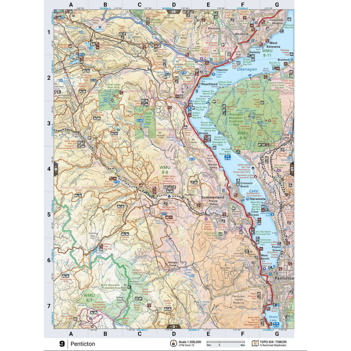
Navigate BC’s southwest with 54 professionally designed topographic maps, packed with labelled recreation sites, highways, trails, and backroads. Trusted by search and rescue teams, these maps set the industry standard for clarity and detail.
| Road Coverage | Over 148,000 km of roads: highways, city, country, logging & industrial |
| Parks & Land | Coverage of Provincial & Regional Parks and Private Campgrounds |
| Fishing | Fish species and stocking info for countless lakes |
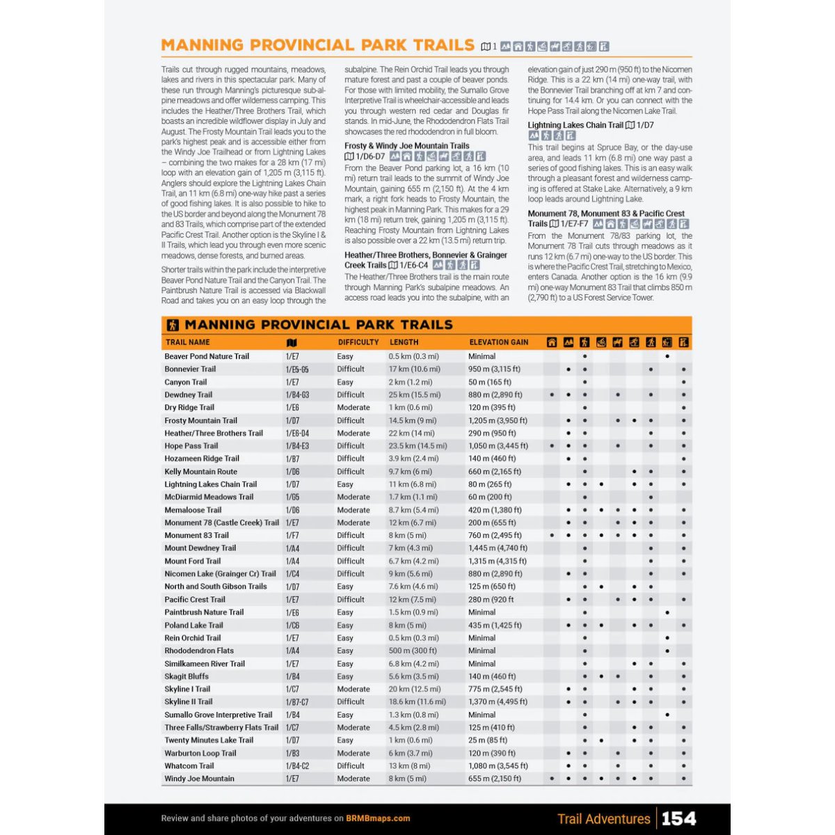
| Trails | Trail charts for top hiking areas like Manning, Mount Robson, Wells Gray & Okanagan Park |
| Hunting | Region-specific WMU boundaries (Region 3 Thompson & Region 8 Okanagan) |
| Descriptions | Includes 14 Outdoor Adventure sections with descriptions for the top adventures in the region. |
| Communities | Comprehensive Community Profiles throughout BC’s interior |
| Indexes | Easy-to-use navigation tools + Adventure & Map Index |
Format & Size:
- Size: 21.5 × 28 cm (8.5 × 11 in)
- Spiral-bound, durable format
- 288 pages including: 51 topographic maps at 1:200,000 scale and 14 Outdoor Adventure sections
- Service Provider Directory
- Trip Planning tools
Adventure Categories
More than just a map – this is your ultimate outdoor adventure guide. Compiled by local experts, our Adventure section covers everything from hiking and paddling to hunting and snowmobiling, offering the most comprehensive listings available for the Thompson-Okanagan region.
| Backroad Attractions | 95+ natural and man-made sites, from the dramatic Helmcken Falls and Myra Canyon Trestles to towering trees, fire lookouts, and scenic viewpoints. |
| Fishing | 400+ stocked lakes and 80+ rivers, with year-round options and fish species charts for trout, kokanee, and salmon. |
| Hunting | 60+ Wildlife Management Units in Regions 3 & 8 (Thompson & Okanagan), plus game descriptions, tips, and seasonal insights. |
| Paddling | 48+ paddling routes, from tranquil lake circuits to thrilling whitewater runs, complete with portage, camping, and difficulty notes. |
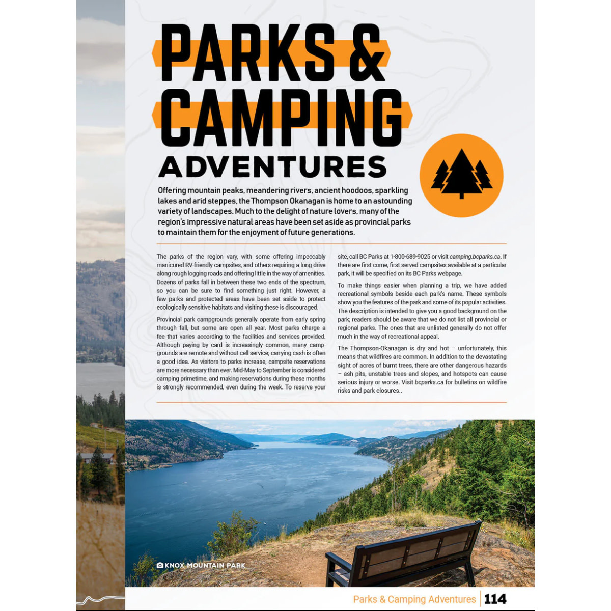
| Parks & Campsites | 100+ Provincial & Regional Parks, with location highlights, activity icons, and travel details from Cathedral to Mount Robson. |
| Rec Sites | 300+ recreation sites, offering a range of experiences from rustic beauty to fully serviced campgrounds, complete with activity icons and detailed facility information. |
| Trail Systems | 380+ multi-use trails for hiking, biking, horseback riding and more, with stats on elevation, difficulty, and scenery. |
| ATV & Overland | 80+ motorized routes for all skill levels |
| Snowmobiling | 70+ riding trails and riding zones, from Kamloops to McBride, with club information, staging, and snow conditions. |
| Wildlife Viewing | 80+ hot spots with species info and seasonal tips |
| Winter Recreation | 50+ ski areas, trails & snow-based adventures |
| Backcountry Cabins | 40+ huts & shelters for year-round exploration |
| Rock Climbing | 5 featured climbing zones |
| Beaches | 13 sun-soaked spots for summer fun |
| Diving Sites | 11 underwater exploration locations |
Every activity and location is easily accessible through dedicated indexes, so you spend less time flipping pages and more time planning the fun.
Add your review
Review Thompson Okanagan BC Backroad Mapbook (7th Edition)