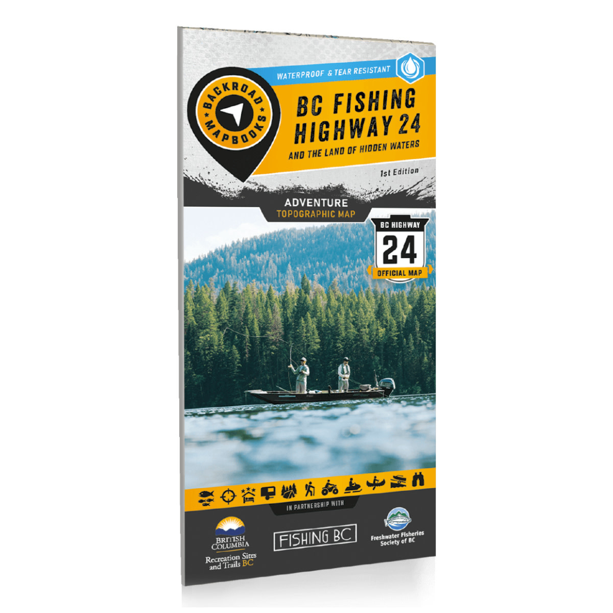
Product details
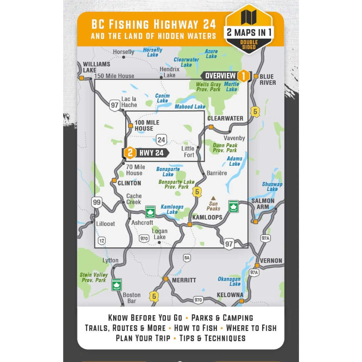
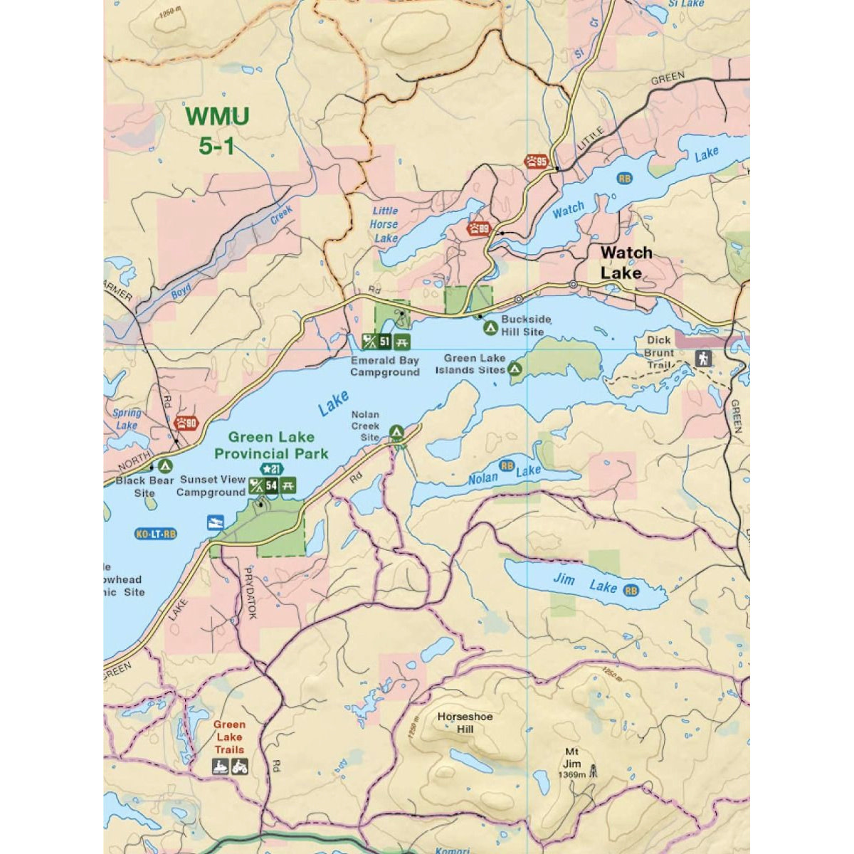
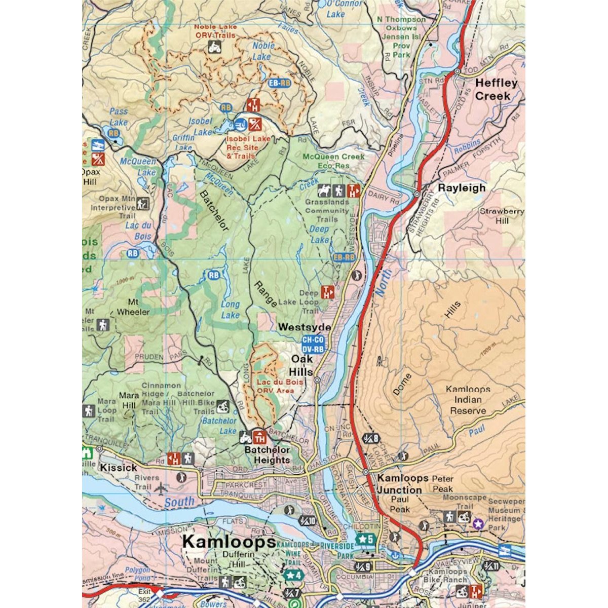
Located within the stunning Cariboo Chilcotin Coast & Thompson Okanagan regions of British Columbia, the Land of Hidden Waters and BC Fishing Highway 24 corridor features some of the most well-known and best fishing lakes in the province. Highlighting lakes such as Adams Lake, Fawn Lake, Sheridan Lake, Barriere Lakes, Bridge Lake, Canim Lake, Green Lake, and Lac des Roches, and featuring regions from Kamloops to Clearwater, Logan Lake to Lac La Hache and 100 Mile House to Little Fort and surrounding areas including Wells Gray Provincial Park, this map is the perfect planning tool for anglers and outdoor enthusiasts of all skill levels. Whether you are looking for new local lakes to fish and explore or planning a multi-day road trip to this fantastic region, this map gives you the most comprehensive coverage available.
This special edition recreation map features an overview map of the Land of Hidden Waters on one side, with a zoomed-in map of the famed BC Fishing Highway 24 on the other side. In addition to these two comprehensive maps, we have included several trip planning sections:
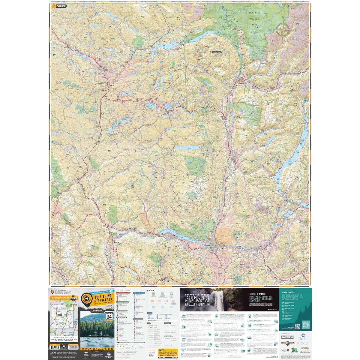
- Featured Points of Interest
- How to Access the Area
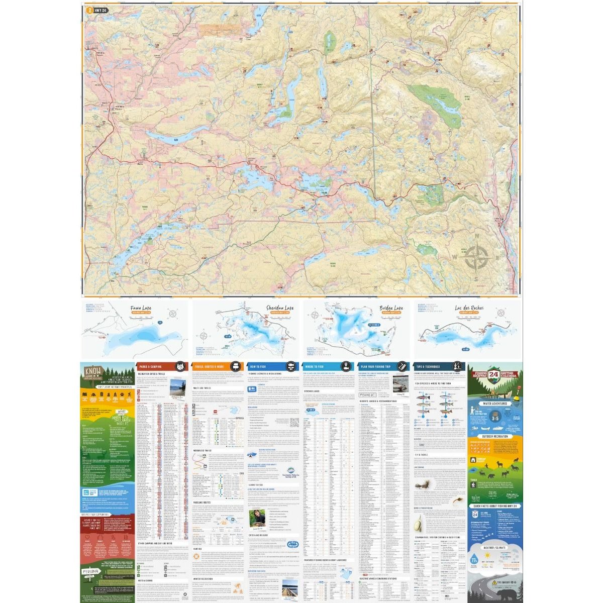
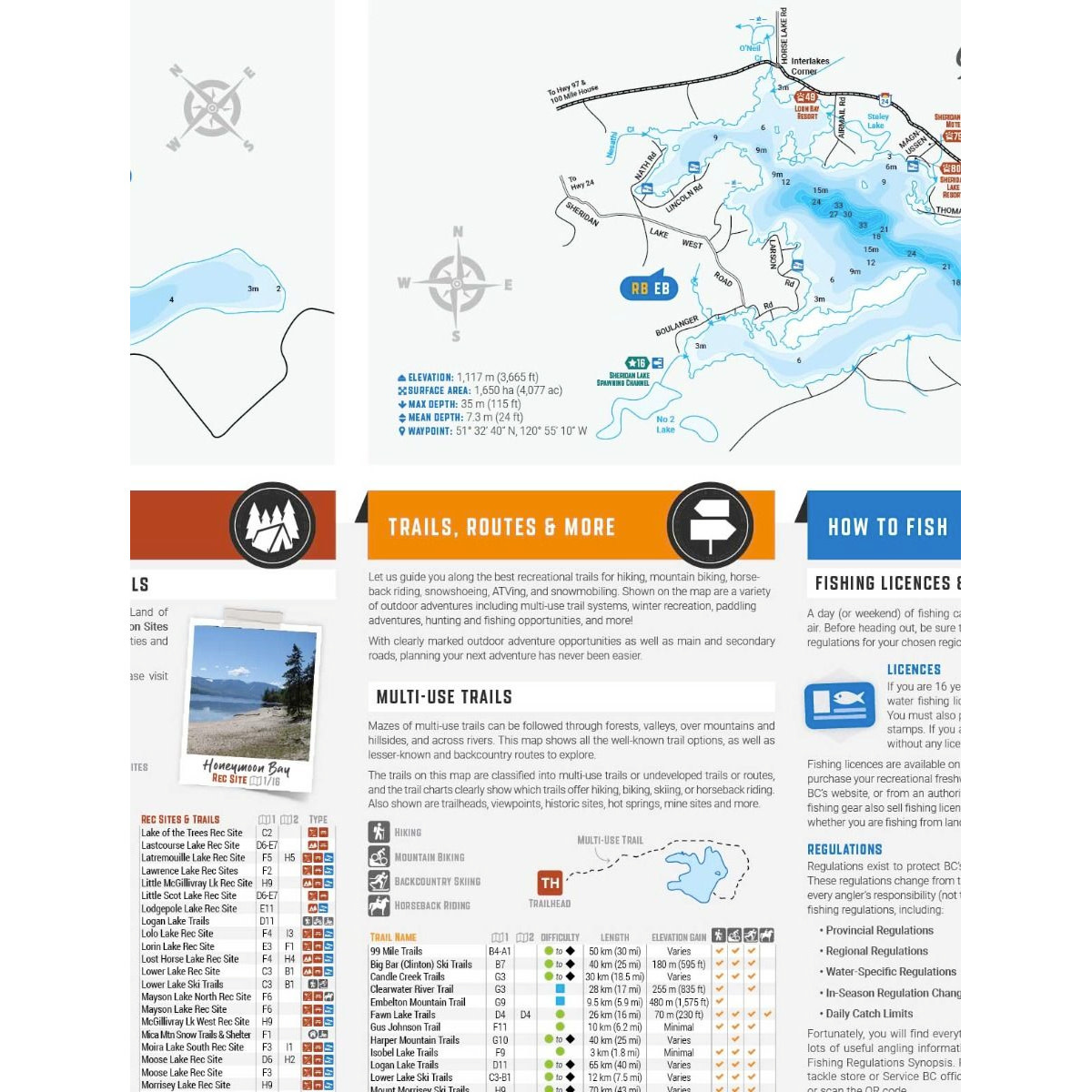
- Lake Depth Charts (Fawn Lake, Sheridan Lake, Bridge Lake, Lac Des Roches)
- Know Before You Go (Leave no Trace, Encountering Wildlife, Clean Drain Dry, Respect for Communities)
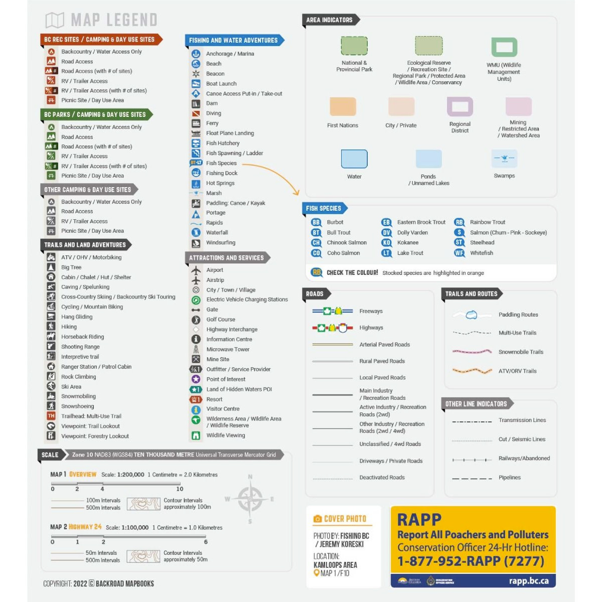
- Parks & Camping (BC Recreation Sites & Trails, BC Parks, Other Camping & Day Use Sites)
- Trails Routes & More (Multi-Use, Motorized, Paddling, Hunting, Winter Recreation)
- How to Fish (Fishing Licenses & Regulations, Fishing Programs, Catch & Release)
- Where to Fish (Stocked Lakes & Rivers, Featured Fishing Docks & Boat Launches)
- Plan Your Trip (Resorts, Guides & Accommodations, EV Charging Stations)
- Fishing Tips & Techniques (Fish Species, Fly & Tackle, Communities, Visitor Centres & Outfitters)
- Fishing Highway 24 (Water Adventures, Outdoor Recreation, Wildlife, Quick Facts about Highway
- 24, Weather/Climate)
Print Features
- Printed on durable waterproof and tear-resistant material
- Easy to read, large-scale 86 x 117 cm (34 x 46.25 inch) maps covering the larger Land of Hidden
- Waters area along with a detailed map of the BC Fishing Highway 24 corridor, derived from our
- Backroad Mapbooks at a scale of 1:100,000 and 1:200,000
- Bonus sections including fishing regulations, lure recommendations, fishing tips and tricks, area attractions, guides and accommodations
- Includes industry-leading cartographic and topographic detail with bathymetric lake depth charts for featured lakes
- The most complete recreation, industry and county road coverage available for Kamloops and the Cariboo region of British Columbia
- Countless points of interest, including boat launches, lake access points, fishing docks, hiking trails, campsites, beaches and more
- Lake and Stream Fishing Species information with boat launches and marinas Detailed indexes for parks and camping, trails, stocked fishing lakes, guides and accommodations, and more
- Seamless map coverage requires no page turning
Add your review
Review Fishing Highway 24 BC (1st Edition)